| Target release | Release name or number |
|---|---|
| Epic | |
| Document status | |
| Document owner | |
| Designer | Lead designer |
| Developers | Lead developer |
| QA | Lead tester |
|
| # | Title | User Story | Importance | Notes |
|---|---|---|---|---|
| 1 | Geo-location of MOD021KM data is inaccurate | When reading this type of data with the SeaDAS reader the geo-location has a shift of several pixels |
| |
| 2 | Provide data as radiance and/or reflectance values | The data is given as raw count values and conversion factors to radiance and reflectance values. User shall either be able to chose between radiance and reflectance or both values shall be provided |
| |
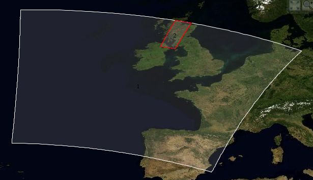
| 3 | Geo-location is wrong if scene crosses dateline | If the data is read by the SeaDAS reader the geo-location is wrong if scene crosses dateline. This is caused by not constructing the longitude tie-point-grid with the DISCONT_AT_180 option |
| |
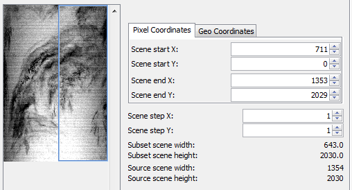
| 4 | When creating a subset of a MODIS product the geo-location gets totally wrong. | The geo-location of a subset is totally wrong in certain cases. This can be best seen when using as subset_region covering only the right part of the scene (full hight). See definition of subset. |
| |
| 5 | MODIS Aqua product 'A****.hdf' shall also work with IDEPIX. |
| ||
| 6 | Use SeaDAS reader directly | Currently we use our own copy of the SeaDAS reader. This gives us the freedom to change code but is not code practice. |
| |
| 7 | It shall be possible to specify the reader on the command line (gpt) | In SNAP GUI the data can be imported using a specific reader. This is not possible on the command line. The reader operator has no parameter for specifying the input format. |
|
Below is a list of questions to be addressed as a result of this requirements document:
| Question | Outcome |
|---|---|
| (e.g. How we make users more aware of this feature?) | Communicate the decision reached |